Service ItemId: 95b2cce919be4240b5e938421ec8e07c
Has Versioned Data: false
Max Record Count: 2000
Supported query Formats: JSON
Supports applyEdits with GlobalIds: False
Supports Shared Templates: True
All Layers and Tables
Layers:
Description:
15 Minute City Index
Version 6
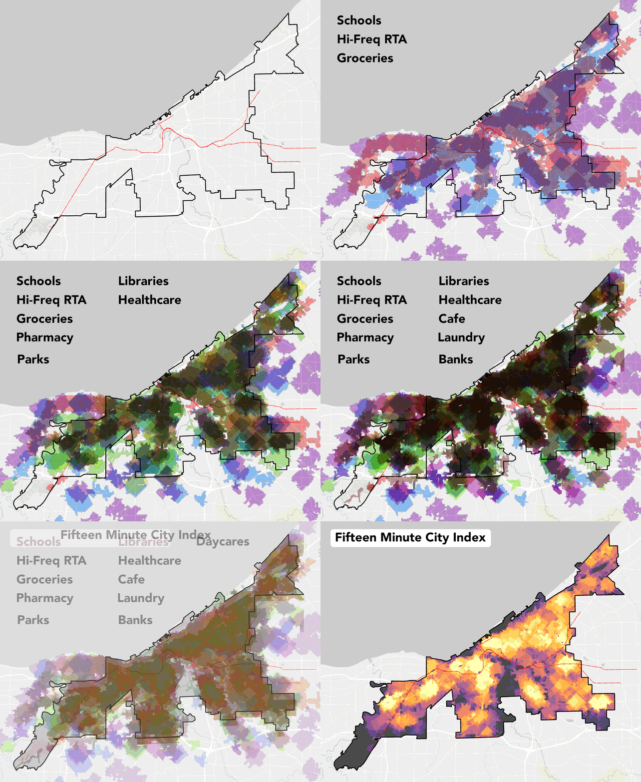
The animation below demonstrates how all the different locations are combined according to weight to create a total index score. The higher the score, the more services, amenities, and stores someone can walk to from that point. This indicates what is nearby but we understand there are many other factors that affect "walkability", like urban design, safety, culture, street design, and more.
This work is preliminary and in development.


Data Glossary
- gridcode - "Index" - The final combined score of all the places someone can reach in 15 minute. Weighting is based on a general literature and meant as a proof of concept. Maximum of 35 points if you can access all.
| Amenity Type | Weight |
| Grocery Store | 5 |
| High Frequency RTA | 5 |
| Schools | 5 |
| Healthcare / Hospital | 3 |
| Public Library | 3 |
| Pharmacy | 3 |
| Park Access | 3 |
| Daycares | 3 |
| Cafes | 1 |
| Laundries | 1 |
| Bank | 1 |
| Fitness Centers | 1 |
| Hair Care | 1 |
Update Frequency
Annually
Contacts
Cleveland City Planning Commission, Strategic Initiatives
cityplanning@clevelandohio.gov
Copyright Text:
Spatial Reference: 102722 (3734)
Initial Extent:
-
XMin: 2132866.59681266
YMin: 603395.365973259
XMax: 2261426.75551469
YMax: 719233.425637074
Spatial Reference: 102722 (3734)
-
XMin: 2138848.31864171
YMin: 628731.517660156
XMax: 2233248.31864174
YMax: 705581.517660171
Spatial Reference: 102722 (3734)
Child Resources: Info SharedTemplates
Supported Operations: Query ConvertFormat Get Estimates Create Replica